Super El Niño 2026/2027: Record-Breaking Growth Signals Historic Winter Impacts
A rapidly intensifying Super El Niño, fueled by record westerly wind anomalies and a powerful Kelvin Wave, is on track to become one of the strongest events on record, with significant implications for global weather patterns this fall and winter.
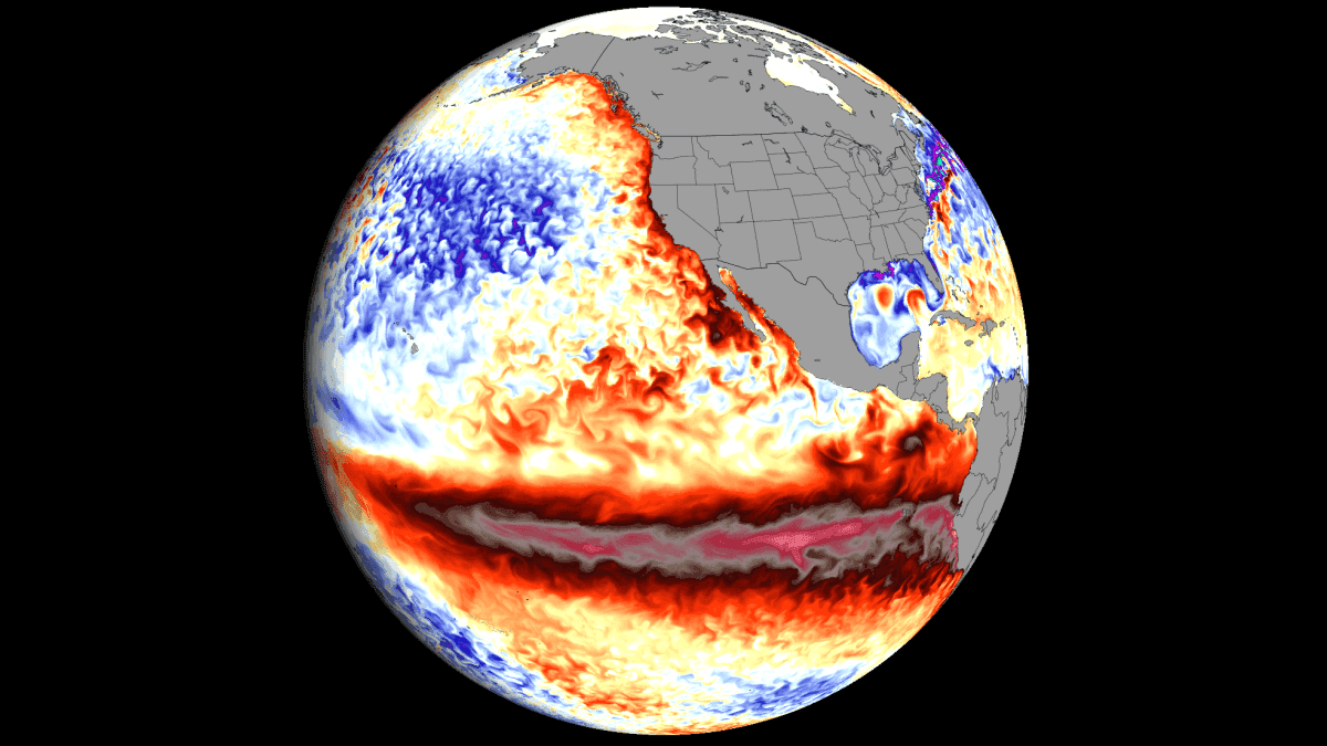
The current Super El Niño is not just strengthening—it's accelerating at a pace that has forecasters revising peak strength estimates upward with each new model run. Recent data shows record-level westerly wind anomalies across the equatorial Pacific, while a powerful Kelvin Wave continues to push warm water eastward beneath the surface, providing the thermal engine for this historic event.
The Mechanics Behind the Surge
El Niño events are driven by shifts in the Walker Circulation, where pressure changes across the tropical Pacific alter global atmospheric patterns. A Super El Niño, defined by sea surface temperature anomalies of +2°C or more in the central ENSO region, triggers a far more aggressive jet stream response than moderate events. This typically leads to a deeper Pacific trough, a stronger Canadian ridge, and an active storm track across the southern United States.
What makes the 2026 event stand out is the energy signature. Subsurface temperature anomalies are peaking at over 9°C above normal—a level that exceeds most, if not all, previous super events. The NOAA CRW analysis shows surface anomalies exceeding +5°C over a large area, with peaks above +6°C. This is exceptionally strong for this stage of development, indicating unusually rapid growth.
Record Wind Anomalies and Model Forecasts
Using ERA5 data, the zonal wind ranking for June and July 2026 shows the broadest region of the western and central equatorial Pacific recording its strongest low-level westerly wind anomalies in 86 years. This sustained trade wind collapse is scientifically significant, as it provides the atmospheric support for one of the strongest El Niño events on record.
The forecast trend is equally telling. The last seven ECMWF runs, released since early February, each show a stronger peak anomaly. The last three runs push the event into record-strong territory, above all previous super events. The NMME multi-model forecast similarly trends upward, with peak anomalies approaching +4°C in the main ENSO region.
What This Means for Fall and Winter
The atmosphere is already responding. Extended-range ECMWF forecasts maintain continuous westerly wind anomalies through late September, indicating robust ocean-atmosphere coupling. This persistence suggests the El Niño will remain strong well into winter, with peak anomalies expected around November-December.
For the United States and Canada, this typically translates to milder conditions in the north and an active storm track across the southern U.S. Europe often sees altered jet stream patterns, which can bring either wetter or drier conditions depending on the exact positioning of the ridge and trough systems.
The key uncertainty remains the exact peak strength. Seasonal models historically underpredict rapid El Niño growth because they cannot simulate individual westerly wind bursts. As these events occur, models adjust upward—and the 2026 event has already shown a consistent upward revision pattern.
The 2026 event has already surpassed the last Super El Niño (2015-2016) in speed and strength, with forecasts now reaching record-strong territory.
| Event | Peak Anomaly (ENSO region) | Development Speed | Forecast Peak |
|---|---|---|---|
| 2015-2016 | +2.5°C | Moderate | N/A |
| 1997-1998 | +2.4°C | Fast | N/A |
| 2026-2027 (current) | +3.0°C+ (projected) | Record-fast | Exceeding +3°C |
Discussion
0 Comments
Be the first to start the discussion.